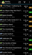


c:geo

وصف لـc:geo
c:geo is an open source, full-featured, always ready-to-go unofficial client for geocaching.com and offers basic support for other geocaching platforms (such as Opencaching). It does not require a web browser or exports - just install it and start right away.
Main features:
- View caches on a Live Map
- Use Google Maps or OpenStreetMaps
- Search for caches by various criteria
- Log your finds online or offline
- Store cache information on your device
- Create and manage waypoints
- Navigate using compass, map, or other apps
- Import/Export GPX files
- Full support for trackables
- Offline caching functions including offline maps
c:geo is a simple to use but powerful geocaching client with a lot of additional features. All you need to get started is an existing account on geocaching.com or another geocaching platform (like Opencaching).
Find caches using the live map or by using one of the many search functions.
Navigate to a cache or a waypoint of a cache with the built-in compass function, the map or hand over the coordinates to various external apps (e.g. Radar, Google Navigation, StreetView, Locus, Navigon, Sygic and many more).
Store cache information to your device directly from geocaching.com as well as via GPX file import to have it available whenever you want.
You can manage your stored caches in different lists and can sort and filter them according to your needs.
Stored caches together with offline map files or static maps can be used to find caches without an internet connection (e.g. when roaming).
Logs can be posted online or stored offline for later submission or exported via field notes.
Search and discover trackables, manage your trackable inventory and drop a Trackable while posting a cache log.
If you have problems installing or using c:geo please first have a look at our FAQ (https://faq.cgeo.org) or consult the user guide (https://manual.cgeo.org).
If there are still problems, contact support via email.
If you would like to know why c:geo needs the permissions requested, please check https://www.cgeo.org for an explanation.
ج: geo هو برنامج مفتوح المصدر ، كامل المواصفات ، جاهز دائمًا للاستخدام غير الرسمي لـ geocaching.com ويقدم دعمًا أساسيًا لمنصات غيوكاشينغ أخرى (مثل Opencaching). لا يتطلب متصفح ويب أو تصدير - فقط قم بتثبيته وابدأ على الفور.
الخصائص الرئيسية:
- عرض ذاكرة التخزين المؤقت على خريطة حية
- استخدم خرائط جوجل أو OpenStreetMaps
- البحث عن ذاكرات التخزين بمختلف المعايير
- سجل الاكتشافات الخاصة بك على الانترنت أو دون اتصال
- تخزين معلومات ذاكرة التخزين المؤقت على جهازك
- إنشاء وإدارة نقاط الطريق
- انتقل باستخدام البوصلة أو الخريطة أو التطبيقات الأخرى
- استيراد / تصدير ملفات GPX
- الدعم الكامل للمتتبعات
- وظائف التخزين المؤقت دون اتصال بما في ذلك الخرائط دون اتصال
ج: geo هو برنامج سهل الاستخدام ولكنه قوي في مجال geocaching مع الكثير من الميزات الإضافية. كل ما تحتاجه للبدء هو حساب موجود على geocaching.com أو منصة غيوكاشينغ أخرى (مثل Opencaching).
ابحث عن ذاكرات التخزين المؤقت باستخدام الخريطة الحية أو باستخدام إحدى وظائف البحث العديدة.
انتقل إلى ذاكرة تخزين مؤقت أو نقطة طريق من ذاكرة التخزين المؤقت مع وظيفة البوصلة المدمجة ، أو الخريطة أو تسليم الإحداثيات إلى تطبيقات خارجية مختلفة (على سبيل المثال ، Radar و Google Navigation و StreetView و Locus و Navigon و Sygic وغيرها الكثير).
تخزين المعلومات المخبأة على جهازك مباشرة من geocaching.com وكذلك عن طريق استيراد ملف GPX ليكون متوفرا وقتما تشاء.
يمكنك إدارة مخابئك المخزنة في قوائم مختلفة ويمكن فرزها وتصفيتها وفقًا لاحتياجاتك.
يمكن استخدام ذاكرة التخزين المؤقت المخزنة مع ملفات الخرائط غير المتصلة بالإنترنت أو خرائط ثابتة للعثور على ذاكرة تخزين مؤقت بدون اتصال بالإنترنت (على سبيل المثال عند التجوال).
يمكن نشر السجلات عبر الإنترنت أو تخزينها في وضع عدم الاتصال لإرسالها لاحقًا أو تصديرها عبر الملاحظات الحقلية.
ابحث عن المتتبعات واكتشفها ، وادِر مخزونك القابل للتتبع وإسقاط التتبع أثناء نشر سجل ذاكرة التخزين المؤقت.
إذا واجهت مشاكل في تثبيت أو استخدام c: geo ، يرجى أولاً إلقاء نظرة على الأسئلة الشائعة (https://faq.cgeo.org) أو الرجوع إلى دليل المستخدم (https://manual.cgeo.org).
إذا استمرت المشاكل ، فاتصل بالدعم عبر البريد الإلكتروني.
إذا كنت ترغب في معرفة السبب في أن c: geo يحتاج إلى الأذونات المطلوبة ، يرجى التحقق من https://www.cgeo.org للحصول على توضيح.


